Hurricane Beryl, which devastated islands in Grenada on Tuesday and is now heading toward Jamaica and the Cayman Islands, has broken records as the earliest hurricane ever to reach Category 4 and Category 5 intensity in the Atlantic Basin. Wind speeds of at least 160 miles per hour were recorded on Monday.
“There are so many superlatives to describe Hurricane Beryl given the time of year, the location and the strength,” said Jonathan Zawislak, a meteorologist and flight director for the National Oceanic and Atmospheric Administration.
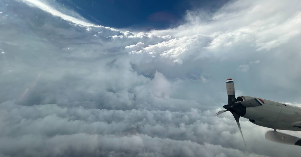
Dr. Zawislak is a hurricane hunter, the title held by about 30 to 40 scientists, data crunchers and pilots based in Lakeland, Fla., who fly into hurricanes on three airplanes nicknamed Gonzo, Kermit and Miss Piggy. Both Kermit and Miss Piggy are equipped with Doppler radar on their bellies and tails that scientists use to create 3-D images of the storm.
Over the last three days, Dr. Zawislak and his team have taken off in Kermit from St. Croix, one of the U.S. Virgin Islands, and navigated through the swirling eyewall of Hurricane Beryl. In a Category 4 or 5 storm like Beryl, the eyewall — the ring of thunderstorms, heavy rain and dangerous winds surrounding the center of the storm — is loud and bumpy.
“It’s like being on a roller coaster in a carwash, except you don’t know when the ups and downs will occur, or what the next turn is,” Dr. Zawislak said on Tuesday as he prepared for his third Beryl reconnaissance flight.