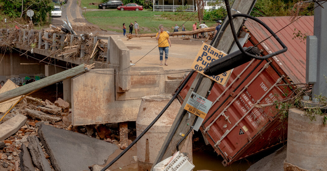
In cooler times, a similarly rare storm over the Southeast would have delivered less rain and weaker winds, a team of scientists concluded in an analysis.
As humans warm the planet, the soaking rains and lashing winds that Hurricane Helene brought last month are becoming increasingly likely occurrences in the Southeastern United States, scientists said Wednesday.
Their assessment is a warning to Americans that Helene, the deadliest hurricane to hit the U.S. mainland in nearly two decades, was rare but no fluke. Instead, it represents the kind of storm that the nation can expect to experience more often as societies continue burning coal, oil and gas for energy.
The report comes as 5.5 million people have been ordered to evacuate ahead of Hurricane Milton, which is expected to make landfall in Florida late Wednesday or early Thursday. Parts of the state are still cleaning up after Helene barreled through two weeks ago.
After analyzing Helene, an international team of scientists estimated that the storm dumped 10 percent more rain than a similarly extreme storm would have done in cooler times. As it roared ashore, its winds were about 13 miles per hour more intense. And the ocean waters from which the storm drew energy were around 2.3 degrees Fahrenheit warmer.
Like all the most destructive hurricanes, Helene was not just a meteorological catastrophe: Its devastation also reflects factors such as local infrastructure and readiness.
“We need to accelerate our preparedness and our adaptation for these types of events that are just beyond what’s imaginable for an individual,” said Julie Arrighi, director of programs at the Red Cross Red Crescent Climate Center and one of the report’s authors. Many of today’s weather calamities are “beyond what we used to consider a once-in-a-lifetime event,” she said.
